
30 years of flooding insights
This article is adapted from a feature first published on LinkedIn in April 2026 to mark 30 years of SEPA.
Flooding remains Scotland’s most severe climate‑related risk — and it’s one that communities across the country have been living with for decades. As flood risk continues to increase, our expanding capabilities are not just technical achievements, they’re essential tools for protecting homes, businesses and vital services, now and into the future.
Building resilience starts with better understanding of current and future risk, and that understanding has never been stronger.
Flood maps development timeline
In the 1990s and early 2000s, our understanding of flood risk was largely shaped by historical records, simple models and low‑resolution datasets.
Early digital mapping enabled us to create Scotland’s first indicative river and coastal flood maps in 2006, offering a broad overview of the potential impacts of flooding. However, these maps didn’t yet represent smaller rivers, surface‑water flooding or account for the increasing influence of climate change.
By the 2010s, the landscape had changed significantly. The Flood Risk Management Act 2009 substantially expanded our role, making us the national leader in assessing, planning, forecasting and co-ordinating flood risk management across Scotland.
As part of these enhanced duties, we were required to carry out national flood risk assessments and develop flood hazard and risk maps for a wider range of sources and scenarios.
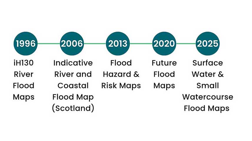
A timeline of flood maps development since 1996.
Advances in data quality, modelling techniques and computing power allowed us to develop much more detailed flood models. In 2013, our current generation of flood maps for rivers, coasts and surface water were first published. In 2020, for the first time, we incorporated climate change projections into our modelling, and published future flood maps for rivers and the coast.
This enabled us to show not only where flooding might occur today, but how risks could evolve in the future - supporting better planning decisions and a stronger evidence base for national policy.
Continuous investment and improvement are essential as data, science, technology and user needs continue to evolve. That’s why we’re on an ongoing journey to strengthen our understanding of river flooding, both now and into the future. Work is well underway to update large areas of our coastal flood maps, with new versions due to be published in the coming months.
In 2025, we launched new national flood maps for surface water and small watercourses, including, for the first time, a future flood map. Together, these updates mark a major step forward in how flood risk is understood and communicated.
Our strategic mapping and modelling capabilities are now more advanced than ever. We use high‑resolution LiDAR data to better represent Scotland’s landscape within our flood models, alongside emerging techniques such as emulation in our latest surface water modelling.
As the climate continues to change, keeping pace with new science and technology will require us to accelerate this progress over the next 5–10 years, ensuring our flood mapping meets growing expectations.
Flood risk maps
We’ve also made our flood maps available online through our dedicated flood map viewer, where you can search by postcode or explore the map to see areas at risk from rivers, the sea and surface water. These maps offer communities, planners and responders faster, clearer and more detailed information than at any point in our history.
The maps are free to use and designed to help the public understand long‑term flood risk, with planning applicants and responders also using them to support decision‑making.
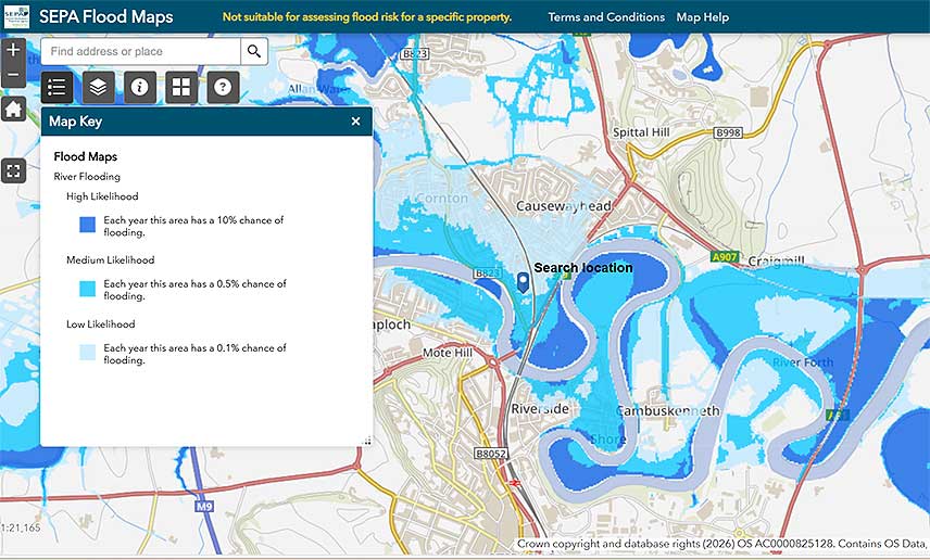
A screenshot of our flood map showing the areas at risk from river flooding and likelihoods.
Understanding Scotland's current flood risk
The National Flood Risk Assessment confirms that flooding remains Scotland’s most serious climate‑related threat. As this risk continues to grow, understanding its scale is vital for strengthening resilience across communities and services.
The latest findings show that one in eight properties — around 400,000 homes, businesses and essential services, are now classed as being at medium risk of flooding, a significant rise from 284,000 in 2018.
Visit our flood risk management planning section to learn more.